How Directional Drilling Works in Jacksonville Ground
Sand country: generous ground, demanding fluid
Northeast Florida's geology is refreshingly straightforward and unforgivingly honest: deep, clean marine sands from the beach ridges inland, well-drained on the uplands, saturated near the water, with the limestone basement far enough down that rock almost never joins utility work — and without the sinkhole drama of the peninsula's karst belt. The craft is entirely in the fluid: clean sand telegraphs annular-pressure mistakes to the surface, collapses on sloppy pullback, and rewards disciplined mud engineering with some of the fastest honest production in the trade. Our sand program — engineered mud, monitored returns, staged containment — is the quote's spine, not its appendix.
Marsh, river, and the wet edges
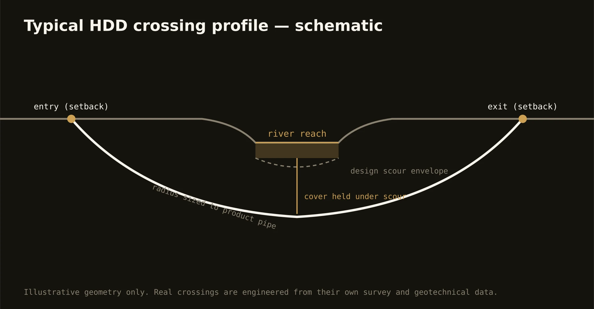
The exception to the easy sand is everything near the water: the St. Johns' fringing marshes, the Intracoastal's spartina flats, the Nassau and Trout and Ortega corridors — organics, soft muds, and tidal groundwater that shift the program to buoyancy math, dewatered pits, and estuary-grade containment. The maps say where; the quote prices the reach it actually crosses, because a ridge-sand number applied to a marsh edge is how schedules drown politely.
The sequence, First Coast edition
The bones are standard — locates plus private designating, potholes on every claimed utility, pilot on profile, ream to about one and a half times the product, pull, restore. First Coast bends: the mud program engineered per reach, dewatering priced where the surficial table sits high, hurricane-season staging awareness, federal manners at the bases' and port's edges, and restoration that treats beach turf, pine flatwoods, and downtown streetscape as the different surfaces they are.
Who owns what you're crossing
The consolidated city's counter governs Duval's local streets, with the beach municipalities running their own; St. Johns, Clay, Nassau, and Baker run county processes; FDOT permits the interstates and state roads. The river brings federal navigation and state environmental review with tidal wetlands jurisdiction; the port, the railroads, and the Navy's installations govern their own ground with windows and access rules; the water management district's permitting rides the wet work. The quote names every owner on your alignment — and inside Duval, that list is often refreshingly short.
Straight answers
Will you hit rock on my bore?
Almost never — the limestone runs deep under this corner of Florida and the sands own the utility zone. The honest cautions are fluid ones: clean-sand pressure discipline, marsh organics at the wet edges, and a water table that joins the pits near the river. The quote prices those real conditions.
How deep do bores run under Jacksonville streets?
Cover follows the owning authority's standard — the consolidated city's, a county's, or FDOT's — and sits below everything potholed on the alignment; river crossings run to navigation-channel engineering. Sand holds a well-made bore at ordinary depths, and the plan states your number before the rig moves.
Does hurricane season change the schedule?
It disciplines the calendar: staging stays storm-aware through the season, marine-adjacent work watches the forecasts, and the rebuild surges after a hit compress timelines the network's scale is built to meet. Florida plans around its season; the trade that serves it does the same.
Ready to put a number on a real crossing? Send the scope — a person prices it.